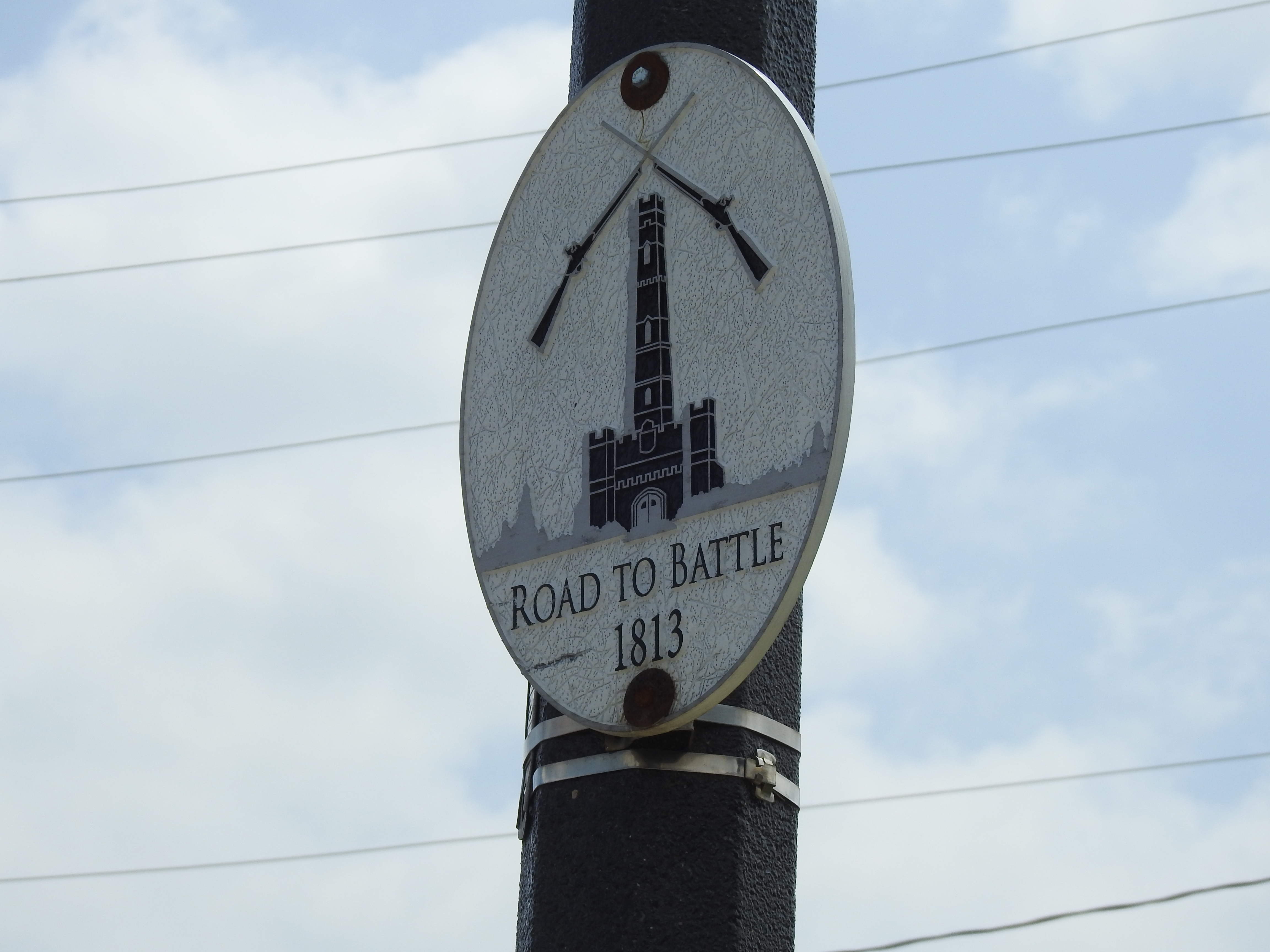
Route sign marking the Road to Battle
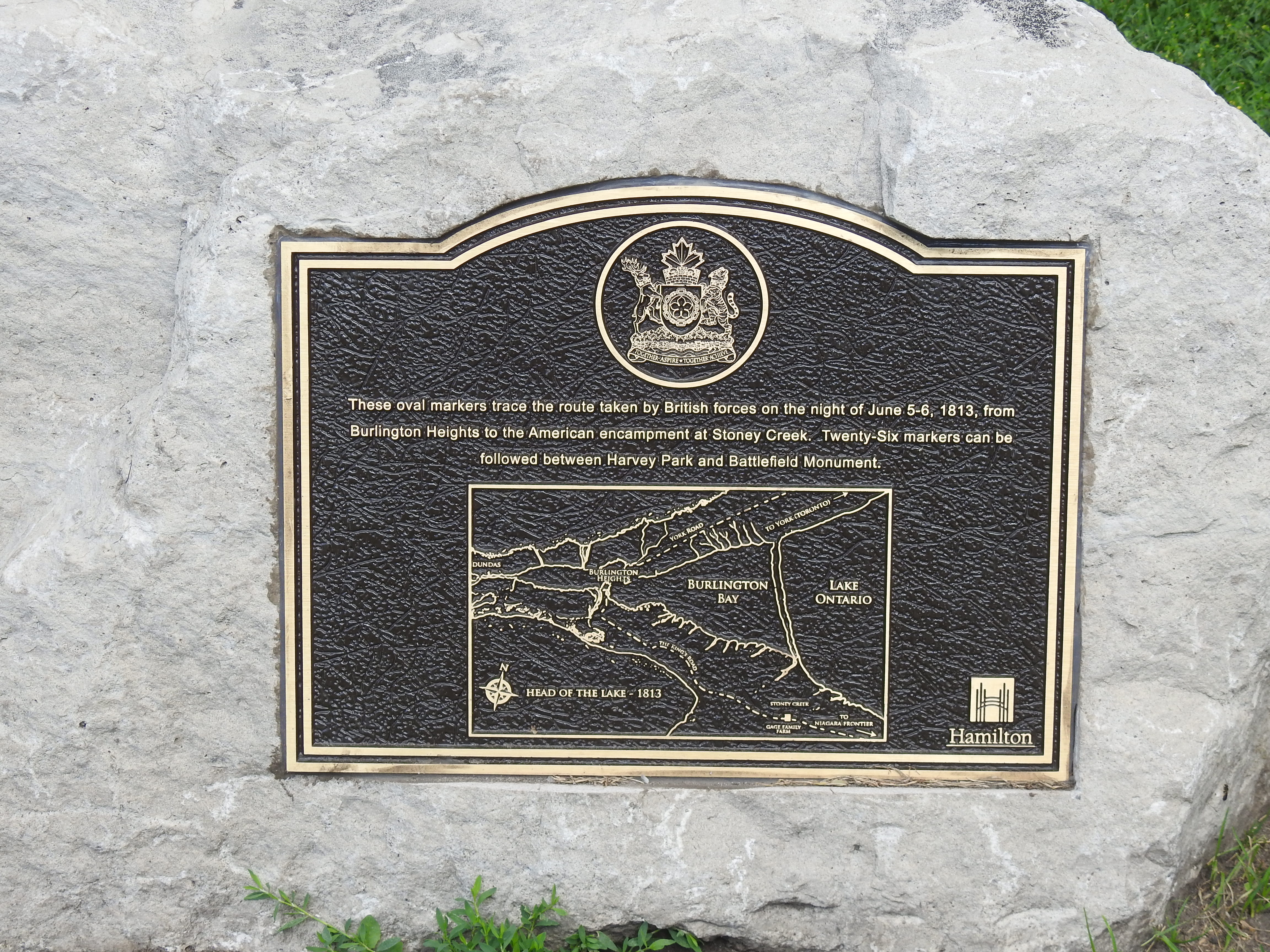
| History: | On the night of June 5 – 6, 1813, 700 British troops from the 8th and 49th Regiments of Foot, under the command of LCol John Harvey
and Major Plenderleath marched through the woods from their encampment at Burlington Heights to Stoney Creek, a distance of about 12.5 km, arriving
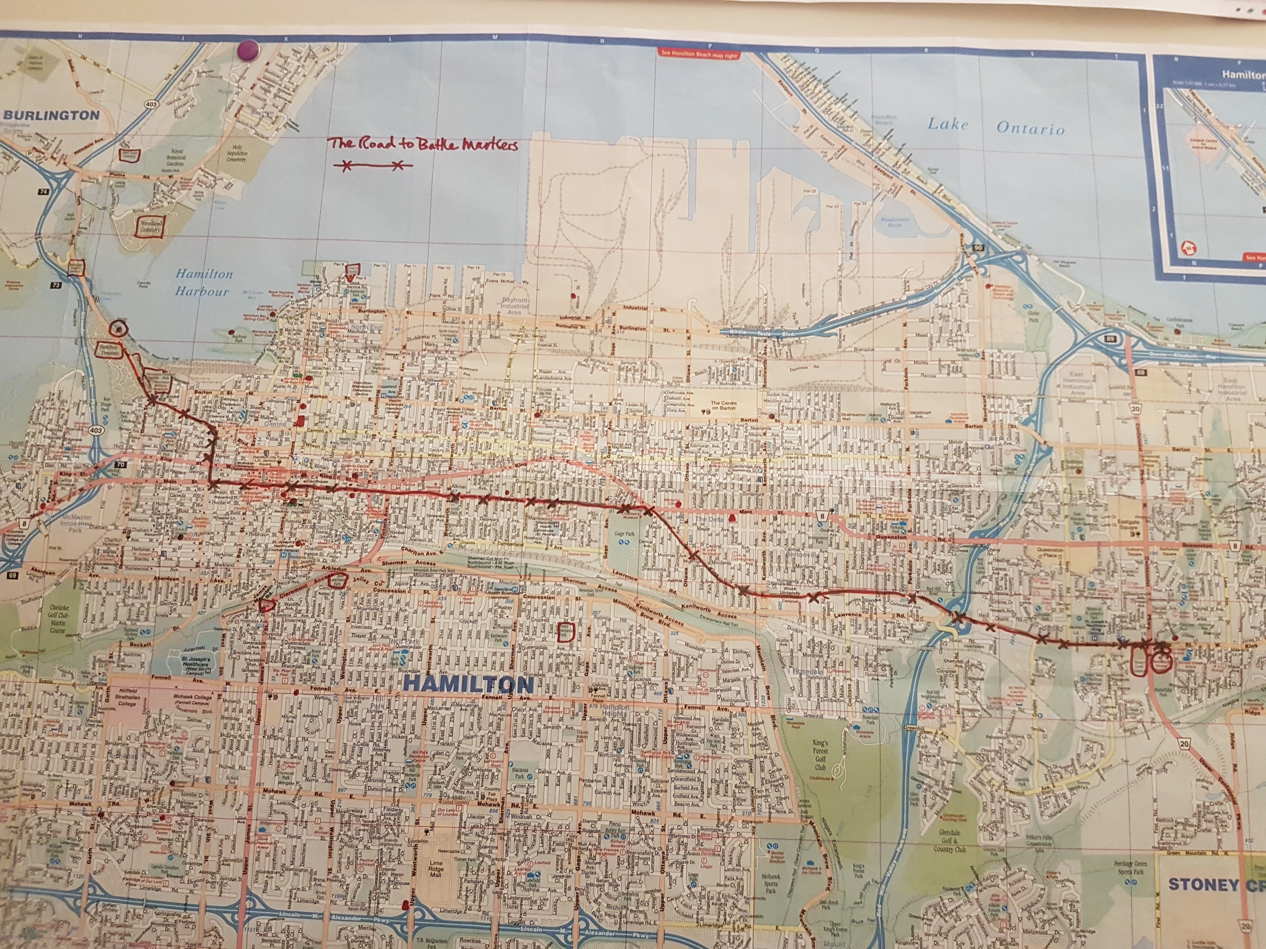
before dawn. There they surprised and defeated the American troops led by Generals Windler and Chandler. Here is an article from the Canadian Encyclopedia about the battle. Here is an article from Parks Canada about the battle. On June 6, 2020, the 207th anniversary of the battle a group of Canadian Forces members, one civilian, and a dog, made the march in commemoration of the original. The Road to Battle marks the route taken by the British troops. There are 26 signs placed at irregular intervals along the route. |
| Harvey Park, Burlington Heights | 610 York Blvd., Hamilton, Ontario, L8R 3E7 |
| GPS: | 43.269401, -79.884262 |
| Battlefield Park | 77 King St. W., Stoney Creek, Ontario L8G 1H9 |
| GPS: | 43.216674, -79.766482 |
 |
 |
|
| Map showing Road to Battle | Historical plaque at Harvey Park, Burlington Heights |
Copyright © CCI Images